 |
||||
GEOLOGY
|
The Lava Flows and Limestones of Litton Dale Geology Field Trip, Monday 26 April 2010 Report by Derek |
||
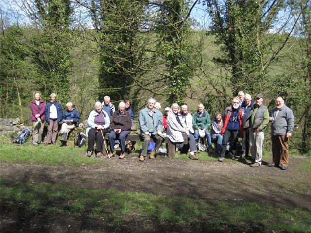
| The party, which numbered twenty one, parked at Millers Dale railway station and walked down the grassy bank to the 'Anglers Rest' pub on the road to Litton. Opposite is the wheel of a former meal mill, with an interesting explanatory notice. From here we continued to: |
Miller's Dale Meal Mill |
|
Outcrop of Lower Miller's Dale Lava by the side of the road leading to Litton |
Locality 1. At the side of the road to Litton at ground level is an outcrop of the Lower Miller's Dale Lava. The top of the flow is marked by a distinct ledge, above which is limestone. Limestone also occurs below the lava in the river bed. The lava, which is formed of basalt, was deposited on the sea floor interrupting the deposition of the limestone. After the volcanic eruption ceased, deposition of the limestone recommenced. The basalt is a brown weathering rock (very distinctive from the grey limestone) and its surface is marked by small holes. These are the remains of gas bubbles in the lava, hence it is known as vesicular lava. These are gas bubbles are often filled with minerals such as calcite. The geological period of these rocks is Upper Carboniferous, about 330m years ago. | |
Closer view of the outcrop of Lower Miller's Dale Lava. Note the gas holes |
Hand specimen of Lower Miller's Dale Lava, showing the gas holes |
|
On the way to the next locality there is a spring at the side of the road. This has developed at the junction of the limestone and lava, the latter being impermeable throws out the water. |
||
Ravenstor with the cave at its base. Note the Lower Miller's Dale Lava forming the floor of the cave. |
Locality 2. Ravenstor. This imposing limestone rock face (popular for rock climbers) is marked at its base by a cave. The floor of this cave is formed by the irregular top of the lava flow, which has weathered into a soft clay and its erosion is partly responsible for the creation of the cave. |
Close up of the cave floor composed of the Lower Miller's Dale Lava. |
| Locality 3. Roadside outcrop of the Miller's Dale Limestone. This limestone is marked by distinct bedding planes (horizontal divisions between the limestone beds) which on investigation are seen to be filled with a thin clay. This clay has been identified as volcanic ash, recording the eruption of a local volcano at the time, interrupting the deposition of the limestone. These ash layers are very widespread in the region and are known as wayboards, a quarryman's term. | ||
Wayboard in the Miller's Dale Limestone. |
Volcanic ash from the wayboard. |
|
 |
Crossing over the river Wye and the headrace of the former cotton mill (now apartments), we climbed up to the track of the former Midland Railway line. This was built in the 1860s from London to New Mills, where it joined the line Manchester-Hayfield line. It closed in 1968. After lunch at a convenient grassy bank, the party moved on to: |
|
| Locality 4. Here, the former railway cutting exposes a fine outcrop of the Monsal Dale Limestone, a darker and less pure limestone than the Miller's Dale Limestone and very closely bedded, the layers not much more than 1-2 feet in thickness. It is notable for layers and nodules of chert, a substance which is made of very tiny crystals of quartz and is very similar to flint. Pre-historic man used it to manufacture tools. Its origin is thought to be due to the accumulation of the siliceous skeletons of millions of tiny creatures. Blocks of this cherty limestone were used in flint mills, such as that at Cheddleton, for grinding imported flint which had been calcined. The resulting paste was then used for the manufacture of chinaware. | ||
Outcrop of Monsal Dale Limestone in the railway cutting, showing the thin beds. |
Close up of a chert band in the Monsal Dale Limestone. |
|
Outcrop in the railway cutting of the snout of the Upper Miller's Dale Lava. Note the boulder of lava caught up in the flow and the limestone draped over the snout. |
Locality 5. In the railway cutting at this extraordinary locality, can be seen the snout of the Upper Miller's Dale Lava, the deposition of which followed sometime after the Lower Miller's Dale Lava, previously seen. The lava ceased moving here (from west to east) and the subsequent limestone was deposited (draped) over the front of the snout at a steep angle which gradually flattens out. Caught up in the lava are boulders which had been dragged along with the flow. |
|
| As the party proceded along the track, it was noticed that the limestone forming the sides of the cuttings was now the Millers' Dale Limestone again, the junction with the Monsal Dale Limestone having moved away to the south. Near Millers' Dale station, the party inspected the limekilns which had been preserved. They closed about 1930 when the adjacent quarry which fed them also closed due to instability. The reason ? The Upper Miller's Dale Lava was too near ! | ||
Miller's Dale Limekilns. |
Interior of limekilns. |
|
There are two railway bridges crossing the river Wye, but only one is open for walkers. The Midland Railway built the second bridge in the early 1900s to deal with increased traffic. Thus Miller's Dale station had five platforms, four for the main line and one for the Buxton branch. In other words, a typical important Midland Railway junction – in the middle of nowhere. |
||
.jpg)
.jpg)
.jpg)
.jpg)
.jpg)
.jpg)
.jpg)
 (2).jpg)
.jpg)
.jpg)
.jpg)
.jpg)
.jpg)
August 2010 |